Place Map
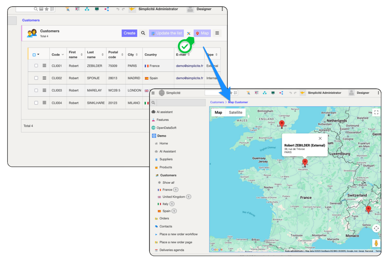
Place Maps are a way to easily show geo-localized objects on a Google Map:
Configuration
Make sur you have the prerequisites:
- update the
GOOGLE_API_KEYsystem parameter after generating it with a Google Account - have a geographical coordinates attribute setup on your object (if working with an address, you might have to use some tool to transform the address into coordinates, see the following example from the demo using a google maps tool and also requires a working Google API key)
And proceed to configure the place map. You can configure up to 3 labels that will show up when clicking on a pin, the first one being considered a title.
Geocoding address
/** Hook override: geo-locate from address fields */
@Override
public String preSave() {
    if (isMainInstance()) { // Only done for the main UI instance
        try {
            // Geocode address fields
            ObjectField coords = getField("demoCliCoords");
            ObjectField a1 = getField("demoCliAddress1");
            ObjectField a2 = getField("demoCliAddress2");
            ObjectField zc = getField("demoCliZipCode");
            ObjectField ci = getField("demoCliCity");
            ObjectField co = getField("demoCliCountry");

            if (coords.isEmpty() || a1.hasChanged() || a2.hasChanged() || zc.hasChanged() || ci.hasChanged() || co.hasChanged()) {
                String a = a1.getValue() + (a2.isEmpty() ? "" : ", " + a2.getValue()) + ", " + zc.getValue() + ", " + ci.getValue() + ", " + co.getValue();
                Location c = new GMapTool(getGrant()).geocodeOne(a);
                coords.setValue(c == null ?  "" : c.toString());
            }
        } catch (Exception e) {
            AppLog.warning(null, e, getGrant());
        }
    }
    return super.preSave();
}